Difference between revisions of "Blauhafen"
Rejistania (Talk | contribs) m |
|||
| Line 51: | Line 51: | ||
[[Image:Blauhafenmap.PNG|The Port of Blauhafen]] | [[Image:Blauhafenmap.PNG|The Port of Blauhafen]] | ||
</center> | </center> | ||
| + | |||
| + | [[Category:Ports]] | ||
Latest revision as of 12:36, 18 July 2006
| Blauhafen (Port) | ||||||||
|---|---|---|---|---|---|---|---|---|

| ||||||||
|
Introduction
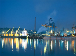
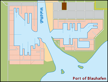
The Port of Blauhafen is the major seaport in the Republic of Hochberg. It is through this seaport, along with the one at English Harbour that the majority of goods pass in and out of Hochberg. The Port of Blauhafen is also home to the Hochen Navy.
Having been established since 1664, the Port has always played a major role in Hochen history, being the location for numerous vessel confiscations. It has also played a major strategic role for many years, being conveniently located at the mouth of the largest river on the island, the Waldfluß that flows straight up into Talstadt. A pair of 12-pounders from the HMS Athene still lie as monuments, in a fort guarding the Port - the historic quarters of which are now a major tourist attraction.
Key facts
The Port...
- Covers an area of over 5,000 hectares
- Has a total quay length of over 30 kilometres
- Has storage capacity for
- 6 million cubic metres of Crude Oil
- 1 million cubic metres of Chemicals
- Utilises
- 98 Cranes
- 24 tugs
- 5 drydocks
- 6 slipways
- Over four million containers pass through Blauhafen every year

