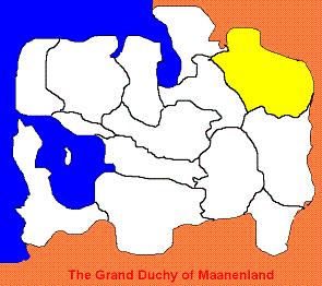
Calder
| |||||||
| Throne Of The Gods | |||||||

| |||||||
| Maanenland Region | |||||||
| Capital | Longeaton | ||||||
| Largest City | Longeaton | ||||||
| Governor | Lieutenant Commander Adrian Sutton | ||||||
| Languages | Dutch,English | ||||||
| Population | |||||||
| - Population | 1,112,928 (14th) | ||||||
| - Density]] | 8 / km2 | ||||||
| Became Part of the Grand Duchy | |||||||
| - Date | 1752 | ||||||
| Time | MMO | ||||||
| Elevation | |||||||
| - Highest Point | 8652m | ||||||
| - Mean Elevation | 2100 m | ||||||
| - Lowest Point | 500 m | ||||||
| Abbreviations | |||||||
| - RMM | CAL | ||||||
| - Landranger | CALD | ||||||
Above New Westminster County , Calder has the second smallest population of any province in Maanenland , moves to incorporate it into the Mountain Districts met surprisingly high levels of resistance the plan was cancelled.
Contents
History
The very first settlers passed through the district in around 3200 BC. A lack of resources and the harsh unforgiving terrain disuaded any permanent settlement. The first town built was in 521 BC at Longeaton , the site was chosen on the strategicly important road in a relativly flat valley. Local farmers and mineral prospectures set up further isolated settlements wherever they could find the land.
The Kingdom of Calder became a distinct political entity after unification by King Vilheim X in 1014 AD.
In 1752 the armies of the Duke of Cliffton conquered the region for Maanenland for it's attractive iron desposists and gold . The armies met with very high resistance in a series of highly costly wars for both sides. Ultimatly the local forces where overwhelmed and the capital fell to Maanenland forces. Until relativly recently there has been active resistiance to Maanenic economic activity in the region.
Economy
The economy is traditionally dominated by small sheep farming , the inaccessibility of the region has meant that tourism on the slopes has been impossible to achieve. Today a large percentage of employment comes from serving the large amounts of military personell that patrol the borders and carry out military excersizes in the area. With a GDP per capita of less than 200 it is also by far the poorest of the provinces.
Politics
The local adminstration is based in the regions largest town of Longeaton , itself with only a population of 100,000 making up roughly 90% of the entire population of the region. Politically the region is split into eight different counties with each having a Officer Designate assaigned to it , only one of 3 provinces that has this arrangement. This is so that the Commander can effectivly run a region with very poor communications. Politics in Calder is dominated by the Maanenland Minority Movement.
Geography
The landscape of Calder is dominated by the mountain range and it's associated ecosystems. Mountains remain snowcovered year-round with some heavy forestry around the bases. All major rivers in Maanenland have at least one source in the region.
| Maanenic Regions | ||
| Albion Island | Calder | Chatham Province | Chesterford Valley | Cliffton Duchy | Dycan Valley | Greater Stretford | Hollings Valley | Kingsborough | Mountain Districts | New Westminster County | Oakshire County| Portland Region | Plainston and Stanston | Ternpool Province | Western Peaks District | ||

