File:ValerianRegionsAndStates.PNG
From NSwiki, the NationStates encyclopedia.
No higher resolution available.
ValerianRegionsAndStates.PNG (405 × 341 pixels, file size: 19 KB, MIME type: image/png)
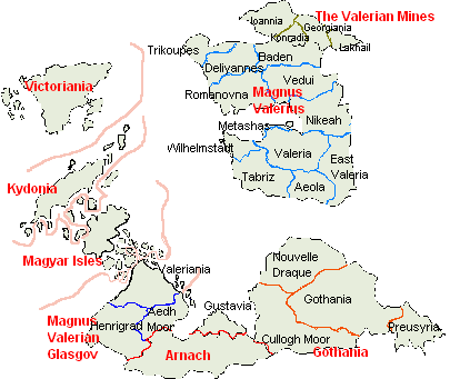
Map of Valerian regions and states. Regions are in red, states in black. Kydonia, Magyar Isles, Arnach, and Victoriania are regions and states at the same time.
File history
Click on a date/time to view the file as it appeared at that time.
| Date/Time | Thumbnail | Dimensions | User | Comment | |
|---|---|---|---|---|---|
| current | 03:02, 23 April 2006 | | 405 × 341 (19 KB) | Magnus Valerius (Talk | contribs) | Map of Valerian regions and states. Regions are in red, states in black. Kydonia, Magyar Isles, Arnach, and Victoriania are regions and states at the same time. |
- You cannot overwrite this file.
File usage
The following page links to this file:
