File:GreaterZedoljevRegions.png
From NSwiki, the NationStates encyclopedia.
No higher resolution available.
GreaterZedoljevRegions.png (700 × 590 pixels, file size: 35 KB, MIME type: image/png)
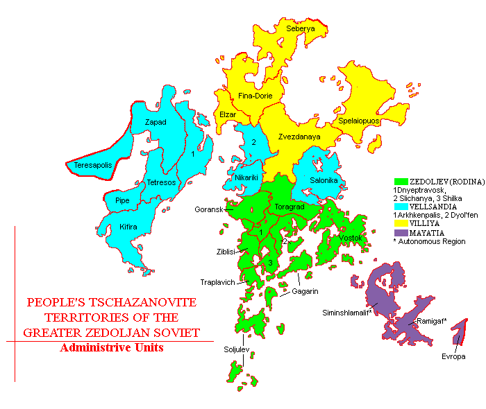
A map of Greater Zedoljev broken down into its respective Republics and states.
Zedoljev is located right at the heart of the PEEL region and controls arguable the most important waterways. Greater Zedoljev actually consists of the original boundaries of The People’s Republic of Zedoljev, and areas of the collapsed nations of Wells-Ville and Mayatland. The new quasi-autonomous Republics are named in their honour.
File history
Click on a date/time to view the file as it appeared at that time.
| Date/Time | Thumbnail | Dimensions | User | Comment | |
|---|---|---|---|---|---|
| current | 18:29, 12 August 2005 | | 700 × 590 (35 KB) | ZedderZulu (Talk | contribs) | A map of ZedoljevGreater Zedoljev]] broken down into its respective Republics and states. Zedoljev is located right at the heart of the PEEL region and controls arguable the most important waterways. Greater Zedoljev actually consists of the orig |
- You cannot overwrite this file.
File usage
There are no pages that link to this file.
