Hamilton Province
| Hamilton Province | |
 |
|
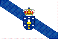
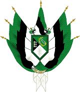
| National flag | Coat of Arms |

| |
| Motto | Inventas vitam iuvat excoluisse per artes. |
| Provincial Capital | Avonbridge |
| Languages - Official - Unofficial |
English, Italian, Latin |
| Lord Protector | Sir Walter Winnitello-Batholomew |
| Area |
48,442 km² 18,810 sq mi |
| Region | The United Federal Kingdom of St Samuel |
| Population - Total (2007) |
21,544,000 |
| Currency | Rudolph |
Hamilton is a province in north-eastern St Samuel. The province borders the Bedivere Province, Arunsdale Province, Ravenscourt Province, Ridefort Province, Montague Province and the Warick Province. The provincial capital is Avonbridge. The current Lord Protector of Hamilton is Sir Walter Winnitello-Batholomew. It's five largest cities are Avonbridge, Dunchester, Orkneyshire, Addlekirk and Oldany.
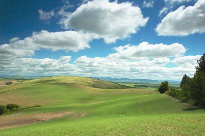
Hamiliton is a serene and picturess province of green lush rolling hills and it's quaint rural villages.
History
146AD - In 146AD King Eades divides the kingdom of Greater Holdinia between Lord Knights that remained loyal to him during the war. Sir Godfrey Hamiliton was made Lord Knight of Hamilton. Sir Hamilton begins construction of a new town, Avonbridge on the river Avonica.
Demographics
Population
21,544,000
Ethnicity
Latin - 59%, White - 17%, Mixed White & Black - 15%, Arab - 6%, Black - 2%, other - 1%
Religion
Catholics - 86%, Orthodox Christian - 7%, Muslim - 4%, Protestants - 3%
Physical geography & Climate
Located on the north east coast of St Samuel, Hamilton has a warm, temperate climate. Rainfall occurs regularly - which has helped keep its countryside green and wooded, but sunny, cloudless days are also common.
In the summer months, temperatures in the region can reach 30 degrees Celsius, but remain comfortable compared to parts elsewhere in St Samuel. Hamilton generally has a moderate climate during both summer and winter, and rain is not uncomfortably common or rare.
Counties
Hamilton is divided into thirteen counties: Mareinashire, West Dabbotshire, Ristainshire, Imanthianshire, Sairogenshire, Anethiashire, Sabeaternianshire, Marielshire, Sybethshire, Nethmarniashire, Robynashire, East Carrowshire and Marthiashire.
Mareinashire
| [[Image:]] |
|---|
Adminstrative Capital: Dunchester
Population:
Towns & Cities
- Dunchester
- Alliance Bay
- Langside
- New Scotland
- Pinecrest
- Tylondale
- Helenshire
- Arindale
- Swainscommons
- Wolfdenfield
- Maplegrave
- Leechefirthe
- Balderstree
- Haverloch
- Dimmocknock
- Lucyloure
- Blaydonsham
- Sayerswall
West Dabbotshire
| [[Image:]] |
|---|
Adminstrative Capital: Avonbridge
Population:
Towns & Cities
- Avonbridge
- Addlekirk
- Anniesland
- Rosscothie
- Stradbrook
- Granadaburg
- Thurhope
- Inglelea
- Gilesfork
- Richbrook
- Faireforde
- Augurwyn
- Muggsmouth
- Hakesthrow
- Clarenbottom
- Rippringswich
Ristainshire
| [[Image:]] |
|---|
Adminstrative Capital:
Population:
Towns & Cities
Imanthianshire
| [[Image:]] |
|---|
Adminstrative Capital:
Population:
Towns & Cities
Sairogenshire
| [[Image:]] |
|---|
Adminstrative Capital: Veldenscliff
Population:
Towns & Cities
- Veldenscliff
- Polmont
- Arden
- Hutchesontown
- Twarbystop
- Spettellark
- Pickesnock
- Croftonforest
- Husseyglen
- Grangeheath
- Aydehearst
- Cotherswake
- Widdowsglove
- Burleybottle
Anethiashire
| [[Image:]] |
|---|
Adminstrative Capital:
Population:
Towns & Cities
Sabeaternianshire
| [[Image:]] |
|---|
Adminstrative Capital:
Population:
Towns & Cities
Marielshire
| [[Image:]] |
|---|
Adminstrative Capital:
Population:
Towns & Cities
Sybethshire
| [[Image:]] |
|---|
Adminstrative Capital:
Population:
Towns & Cities
Nethmarniashire
| [[Image:]] |
|---|
Adminstrative Capital:
Population:
Towns & Cities
Robynashire
| [[Image:]] |
|---|
Adminstrative Capital:
Population:
Towns & Cities
East Carrowshire
| [[Image:]] |
|---|
Adminstrative Capital:
Population:
Towns & Cities
Marthiashire
| [[Image:]] |
|---|
Adminstrative Capital:
Population:
Towns & Cities

